

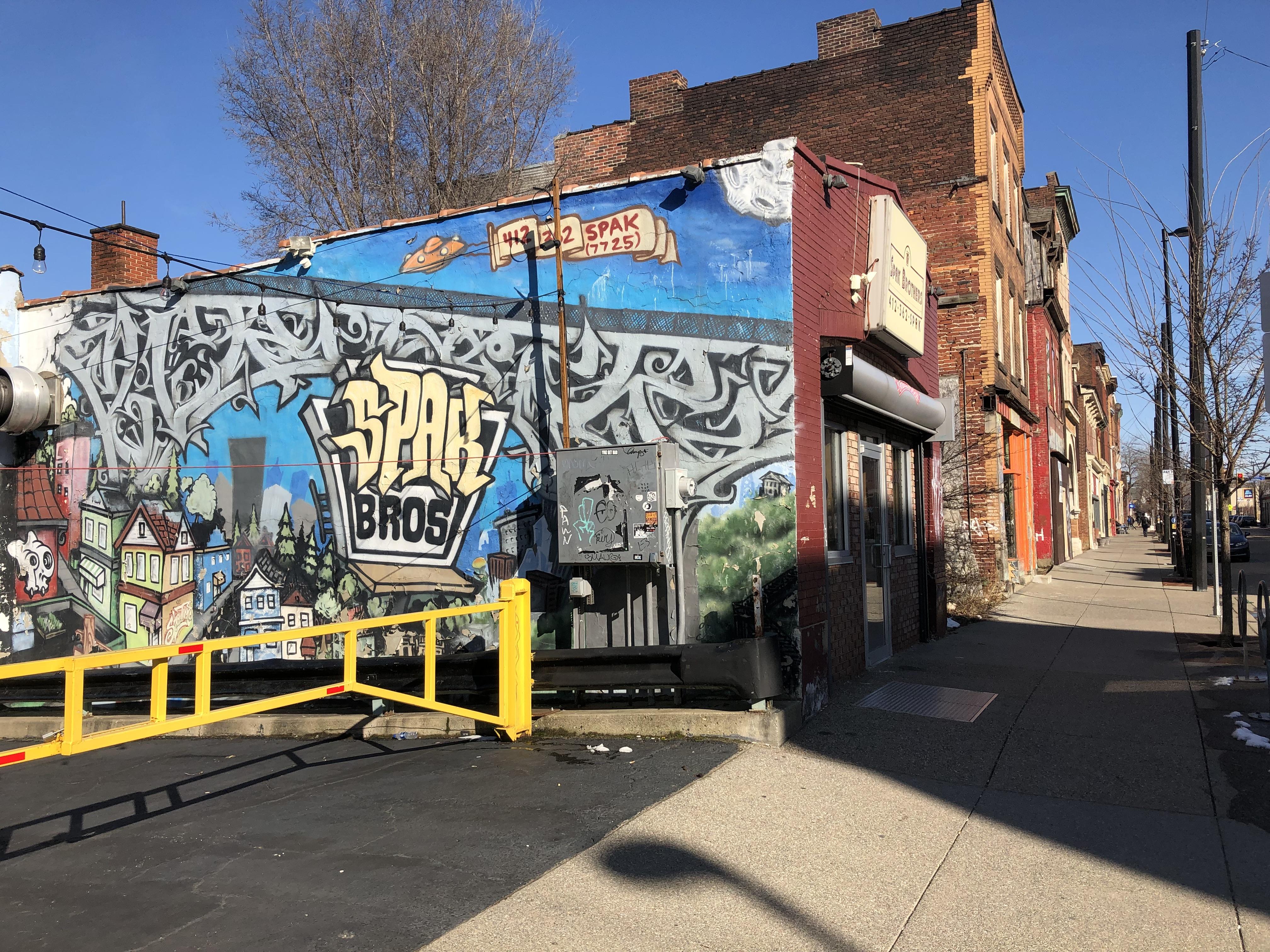
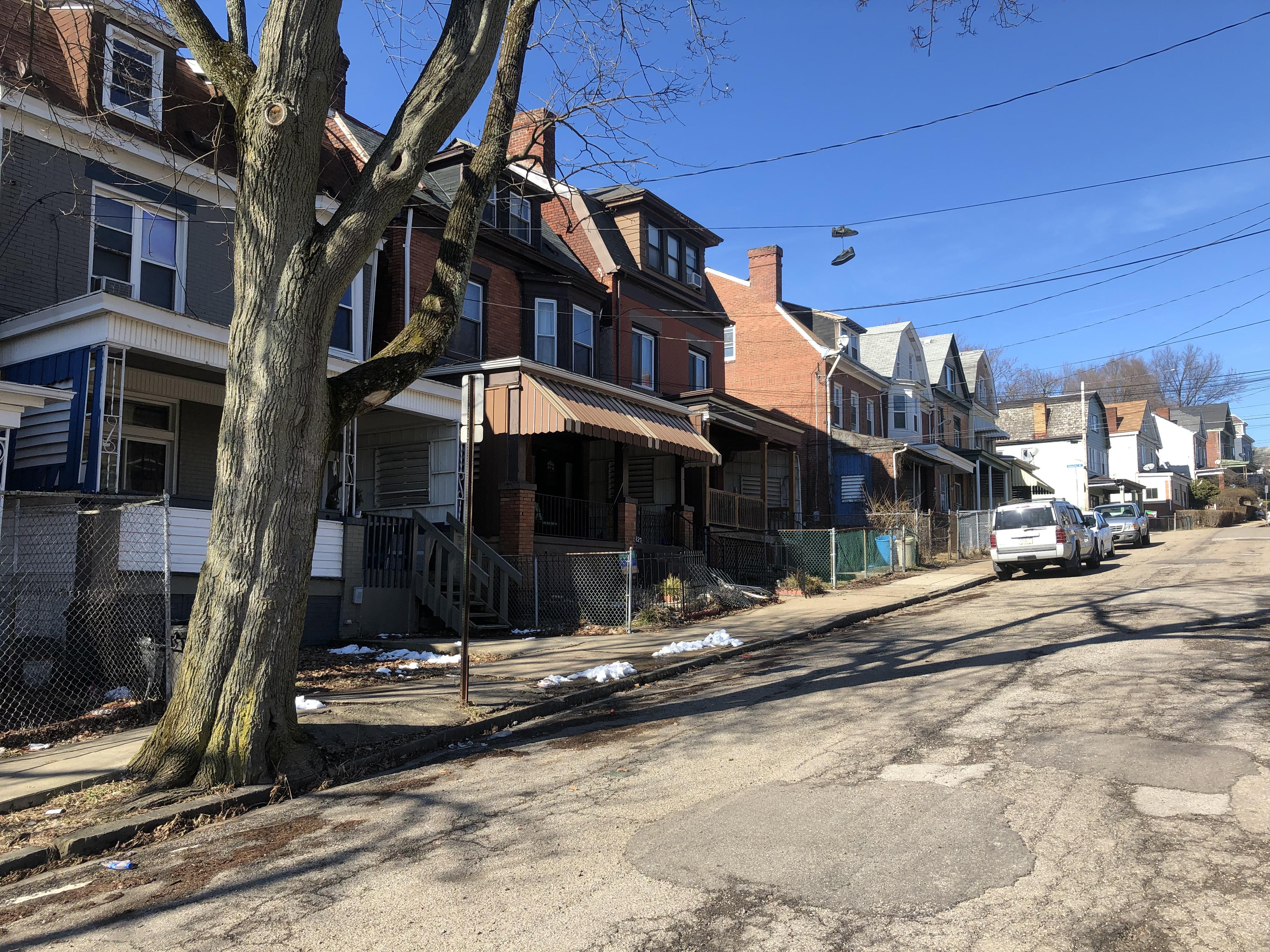
I want to get this out-of-the-way now; I adore Garfield. My first ever rental home was on Broad Street in Garfield and I lived there with some of my best friends for roughly 2 and half years before moving back to Brookline. Our neighbors were overwhelmingly hospitable and sociable. Cook outs were abound (shout out to the time when our neighbor Jimmy liked my instant potatoes more than Cory’s methodically prepared steak). The neighborhood is close to just about everything in the East End via a high degree of walkability and a myriad of public transit options. Grocery stores are quite accessible and Garfield is home to a vibrant business district filled with wonderful Vietnamese, Indian and Black owned restaurants and businesses, the arts and First Fridays, and my favorite DIY (Do It Yourself) all ages music venue in Pittsburgh (aka the Mr. Roboto Project). Well, technically speaking, Roboto is in the most northern part of Bloomfield, but it’s literally across the street from Garfield. And I’ve had the pleasure of both playing and going to shows at Roboto for years. Garfield is filled with some of my favorite post-college and graduate school memories. As such, it’s hard to remove my positive bias towards the neighborhood itself, its institutions and my former neighbors. But like many other neighborhoods in the city, longtime residents of Garfield face steep challenges.
The durably high poverty and overwhelmingly Black Garfield is situated in the northern section of Pittsburgh’s East End and residents on its southern and eastern borders have easy access to several major buses via the Penn Avenue and N. Negley corridors. The 88 rides along the southern border on Penn Avenue and the 77, 87s and the 71 A and C stop at Penn and N. Negley Avenue. And you can catch the 64 just a few blocks north of Garfield at the intersection of Stanton and N. Negley avenues (on the border between East Liberty and Highland Park). Much like East Liberty, Garfield is in prime port authority territory and residents can get to Downtown, the Lawrenceville neighborhoods, the Oakland Neighborhoods, the Strip District, Friendship, East Liberty, Bloomfield, Highland Park and a number of suburban boroughs and more with ease. However, the northern most part of the neighborhood grapples with extreme poverty, and residents there are much more isolated than those on the southern and eastern borders of Garfield – as will be discussed. Garfield is bordered to the west by N Mathilda Street and Mossfield Street, to the north by Mossfield Street and Black street, to the south by Penn Avenue and to the East by N. Negley Avenue. Allegheny Cemetery of Central Lawrenceville borders the neighborhood to the West and Bloomfield, Friendship, Stanton Heights and East liberty border the neighborhood to the southwest, southeast, north and east, respectively.
You are viewing: Where Is Garfield Neighborhood In Pittsburgh

Garfield is located in Pittsburgh’s East End region.
At one time, Garfield was home to Irish immigrants who worked in the mills and foundries along the nearby Allegheny river corridor. And this concentration of working-class Irish Catholics remained in effect from the 1880s to the late 50s and early 60s. However, as was the case with a sizeable portion of Pittsburgh neighborhoods that will be profiled, suburbanization and White out-migration from the 1950s onward, de-industrialization from the late 1970s and 1980s and Urban Renewal in the 1950s and 60s heavily contributed to the depopulation and economic decline of the neighborhood and its transition from one that was once overwhelmingly White and working class to one that is now overwhelmingly Black. And a significant portion of the Black population lives below the Federal Poverty Line. In an attempt to lure suburbanites back into the City, the city’s Urban Redevelopment Authority used eminent domain to buy up houses, businesses and land to repurpose them for automobile focused development and suburban like amenities in nearby East Liberty – which once had the 3rd highest economic output for a business district in Pennsylvania. The plan massively back fired and led to further depopulation and economic depression. And when segregated, Black housing projects were erected in the Northern portion of Garfield and in East Liberty, White residents fled the neighborhoods in droves. Thus, it was racism against Black residents that delivered another blow to a Garfield of times past. The neighborhood was roughly 10,000 strong and 80% White in 1970. As of 2017 American Community Survey estimates, the neighborhood is 72% black and has a population of 3,846 – a roughly 60% decline in population.
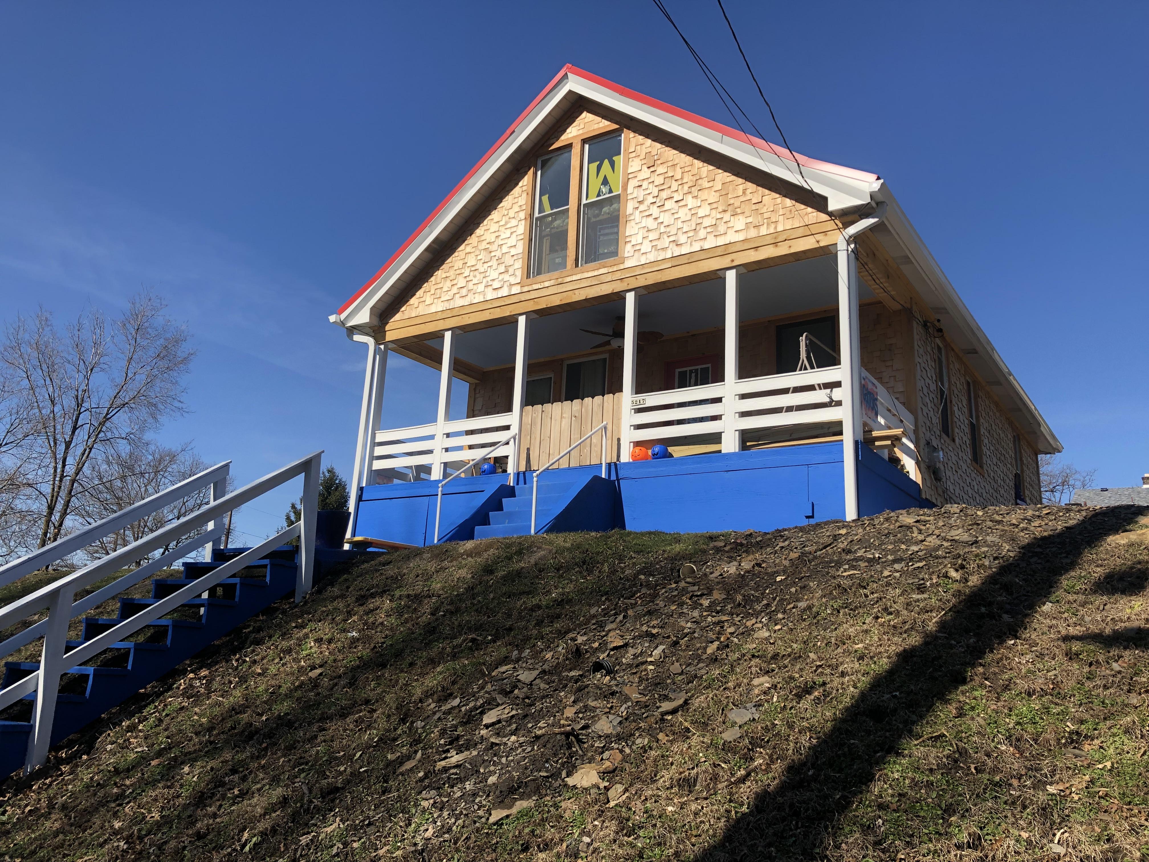
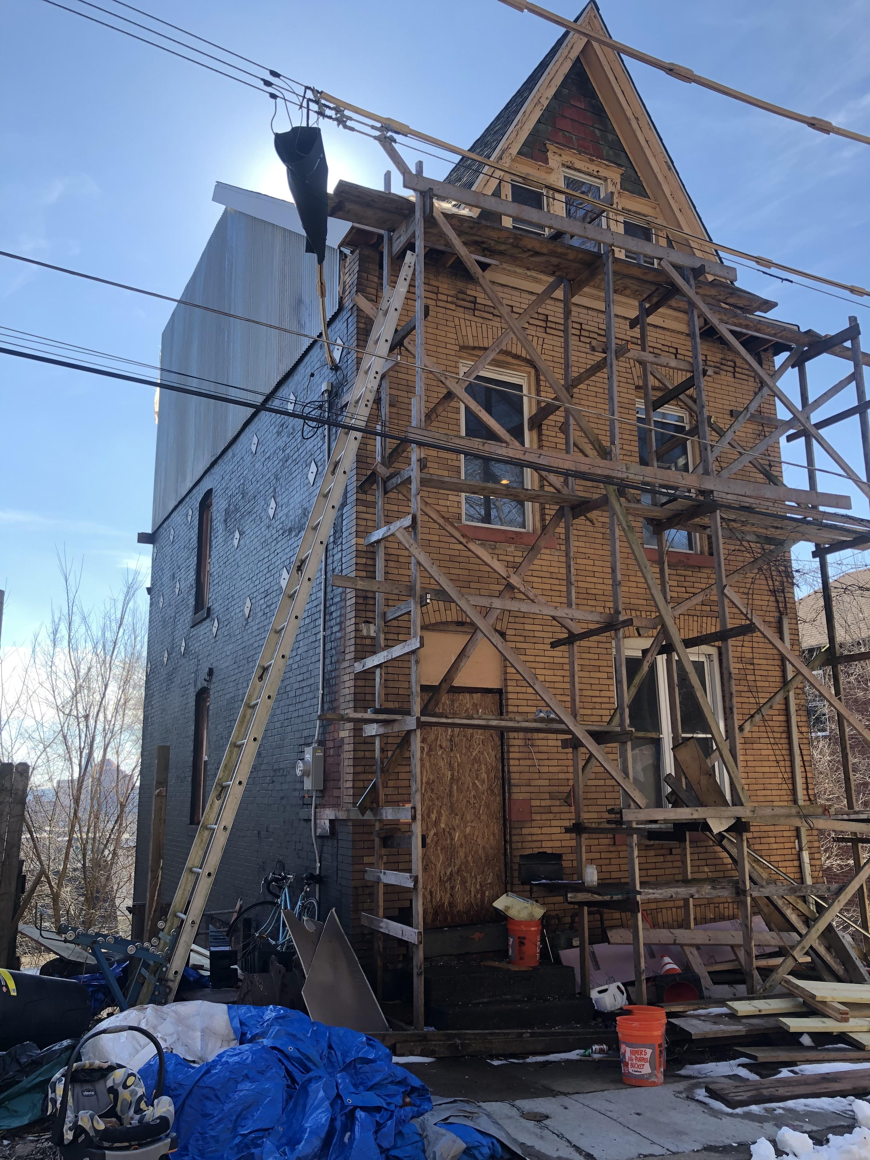
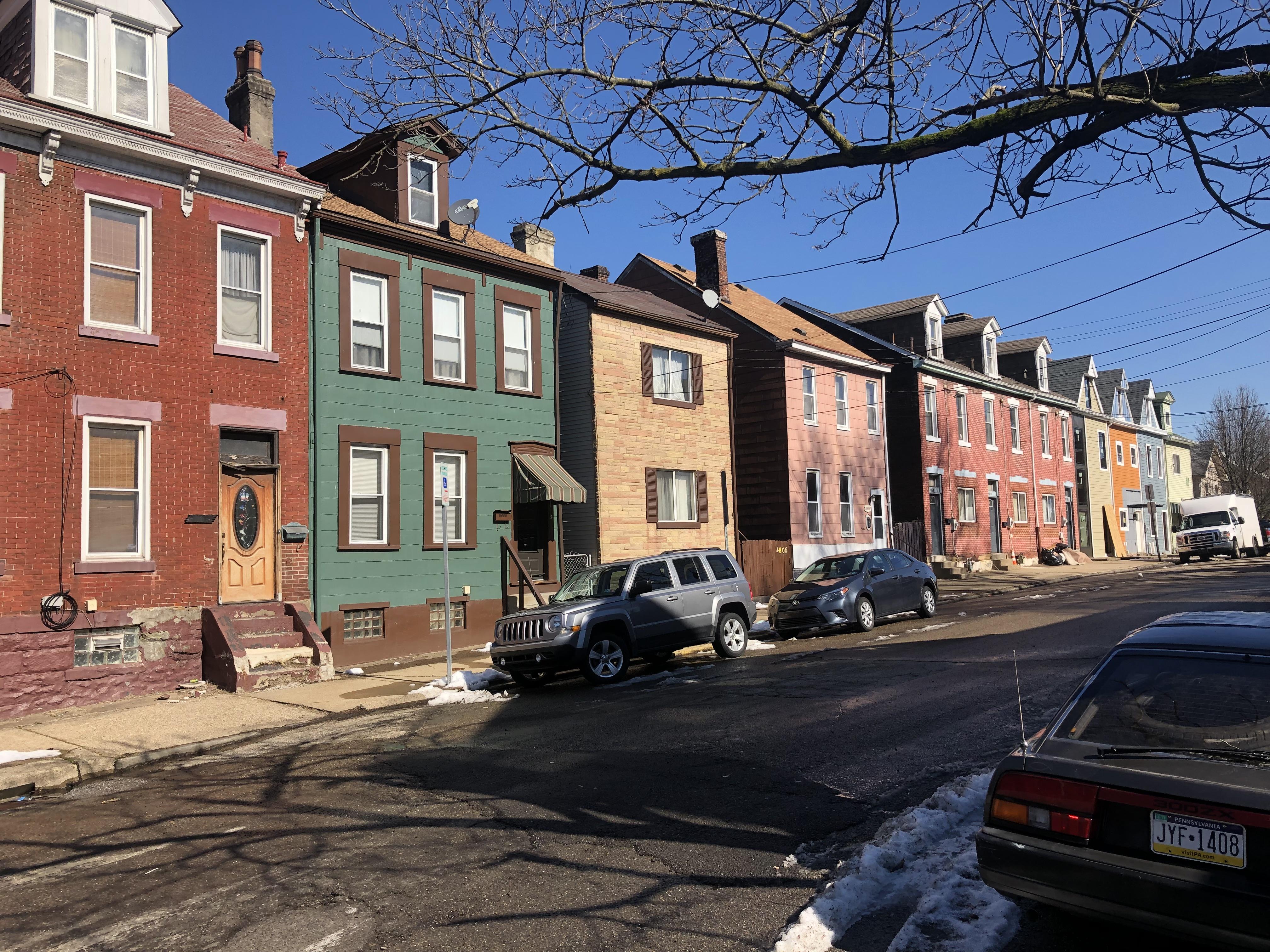
The neighborhood may be high poverty, but its local community development corporations aim to revitalize the neighborhood while keeping it both affordable and mixed income through low-income, moderate and market rate housing rehab and development. The Bloomfield Garfield Corporation and Garfield Jubilee Association have been committed to affordable housing development in the neighborhood, and it shows. Additionally, the Bloomfield Garfield Corporation has a number of home rehab and development initiatives, business improvement programs and an income eligible rent to own program that is dubbed the Garfield Glen Project. The latter was funded via an awarding of Low-Income Housing Tax Credits from the Pennsylvania Housing Finance Agency and received additional gap funding from the Urban Redevelopment Authority. Redevelopment and blight reduction were evident throughout my street by street walk of the neighborhood. Unlike other high poverty neighborhoods, as with our Knoxville profile, Garfield does not appear to be plagued by high rates of neighborhood blight. There were examples of new and rehabbed housing everywhere. And with my own eyes, I saw at least 6 housing rehab crews at work on the beautiful 50 something degree day that I walked the neighborhood. A revitalized commercial corridor focused on the arts and mixed income housing development and rehab have played a significant role in making the neighborhood more desirable for longtime residents, artists and new renters and for home owners looking for a neighborhood that is affordable and close to just about everything and anything the East End has to offer.
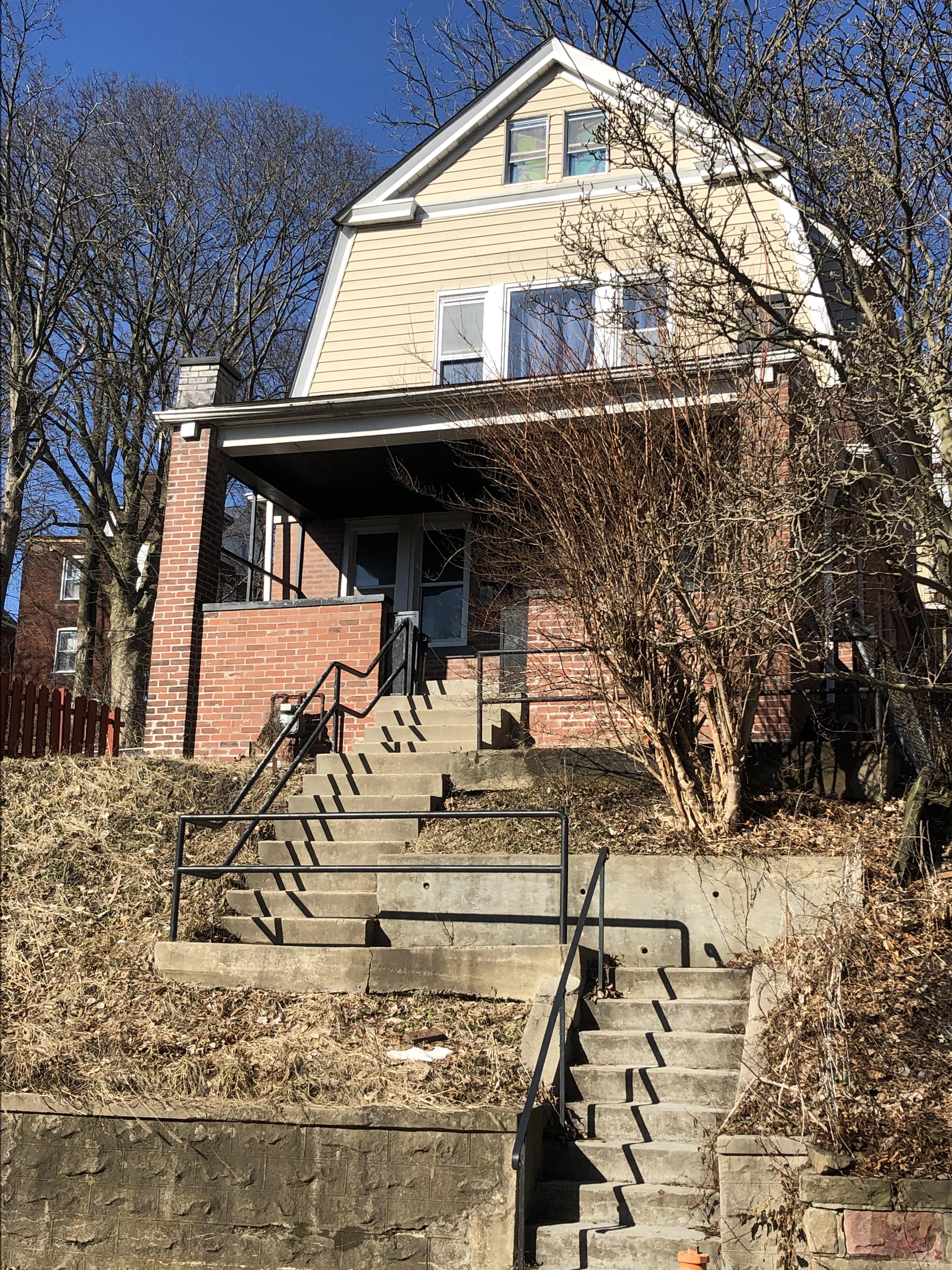
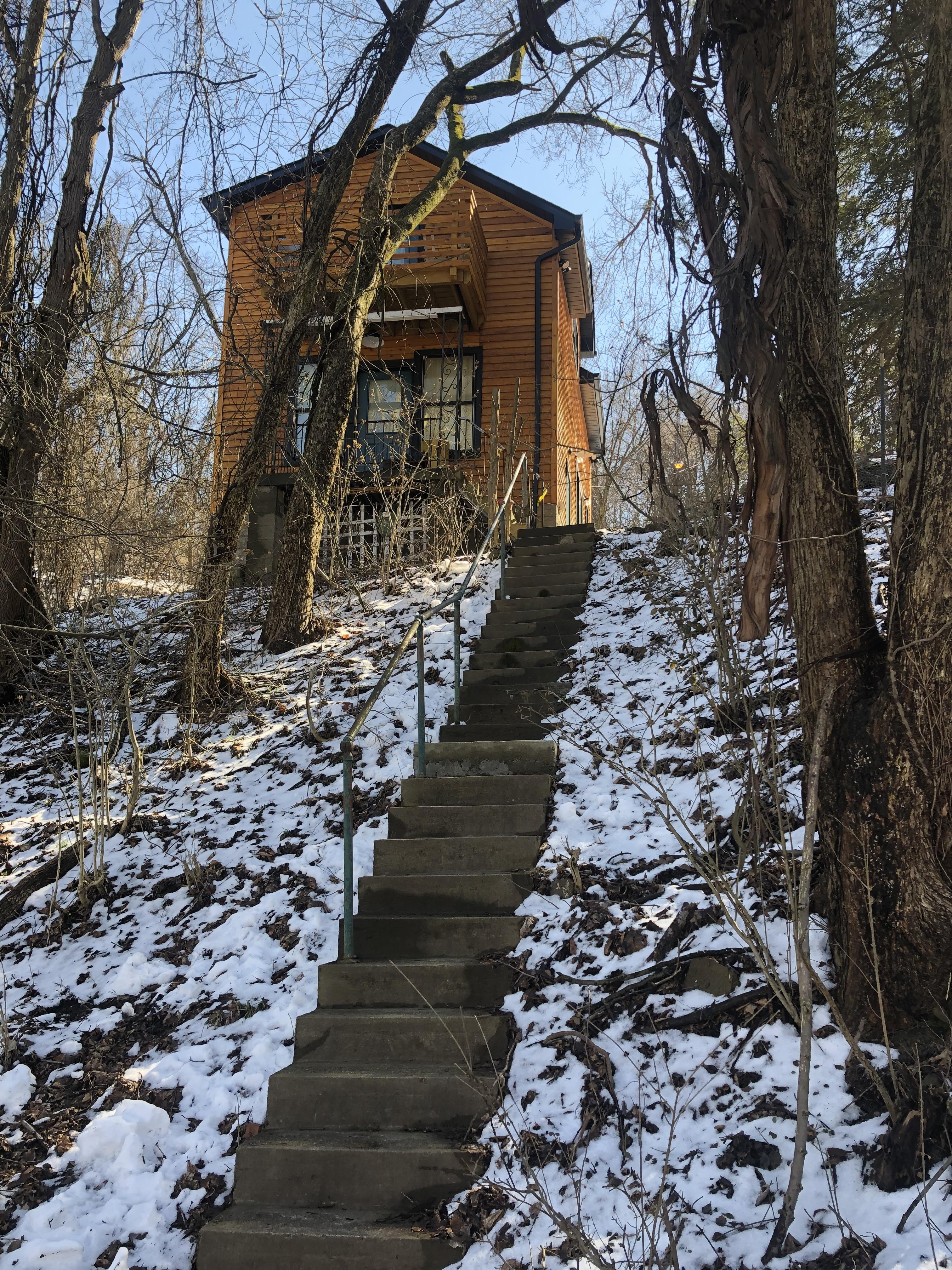
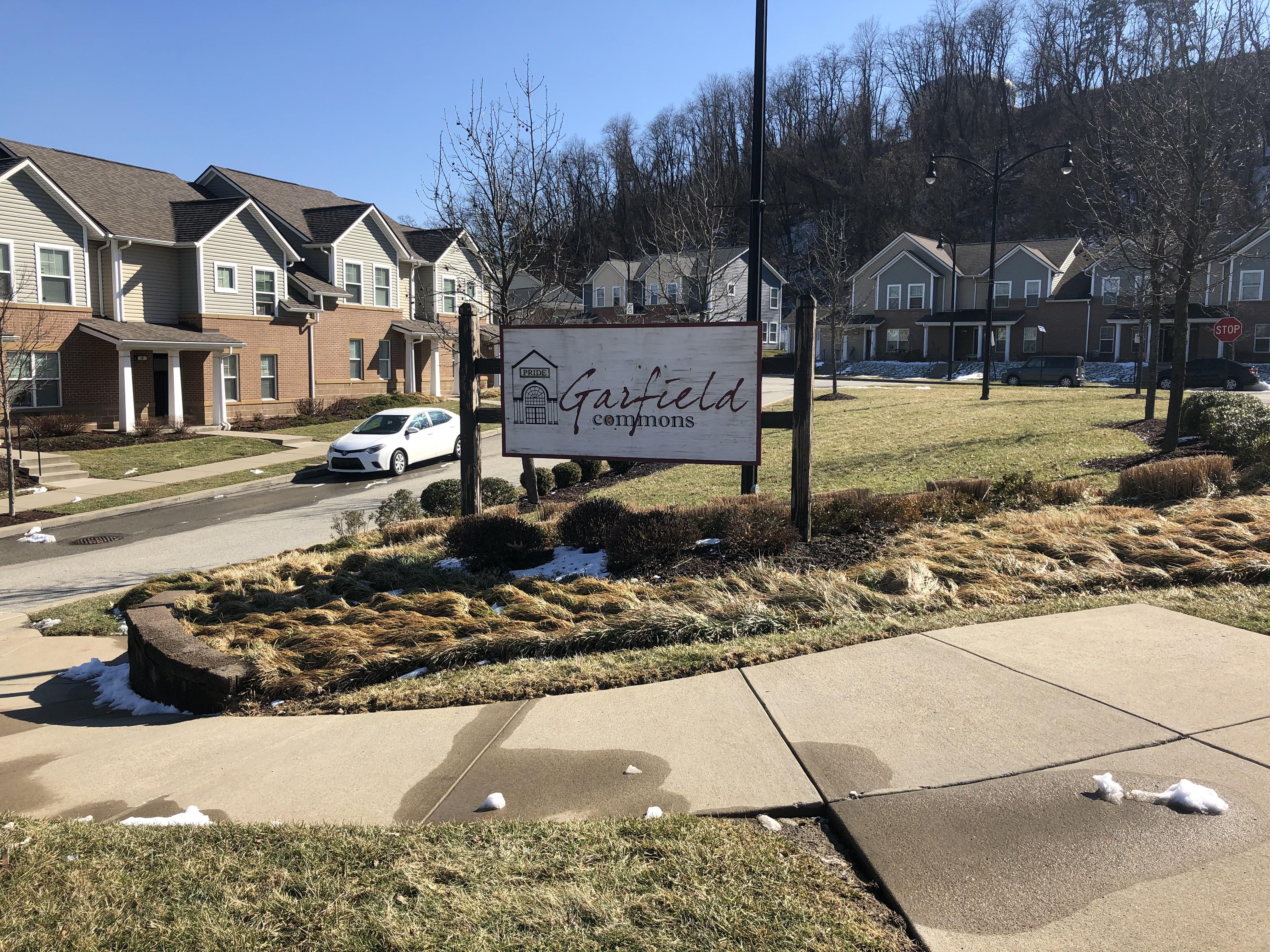
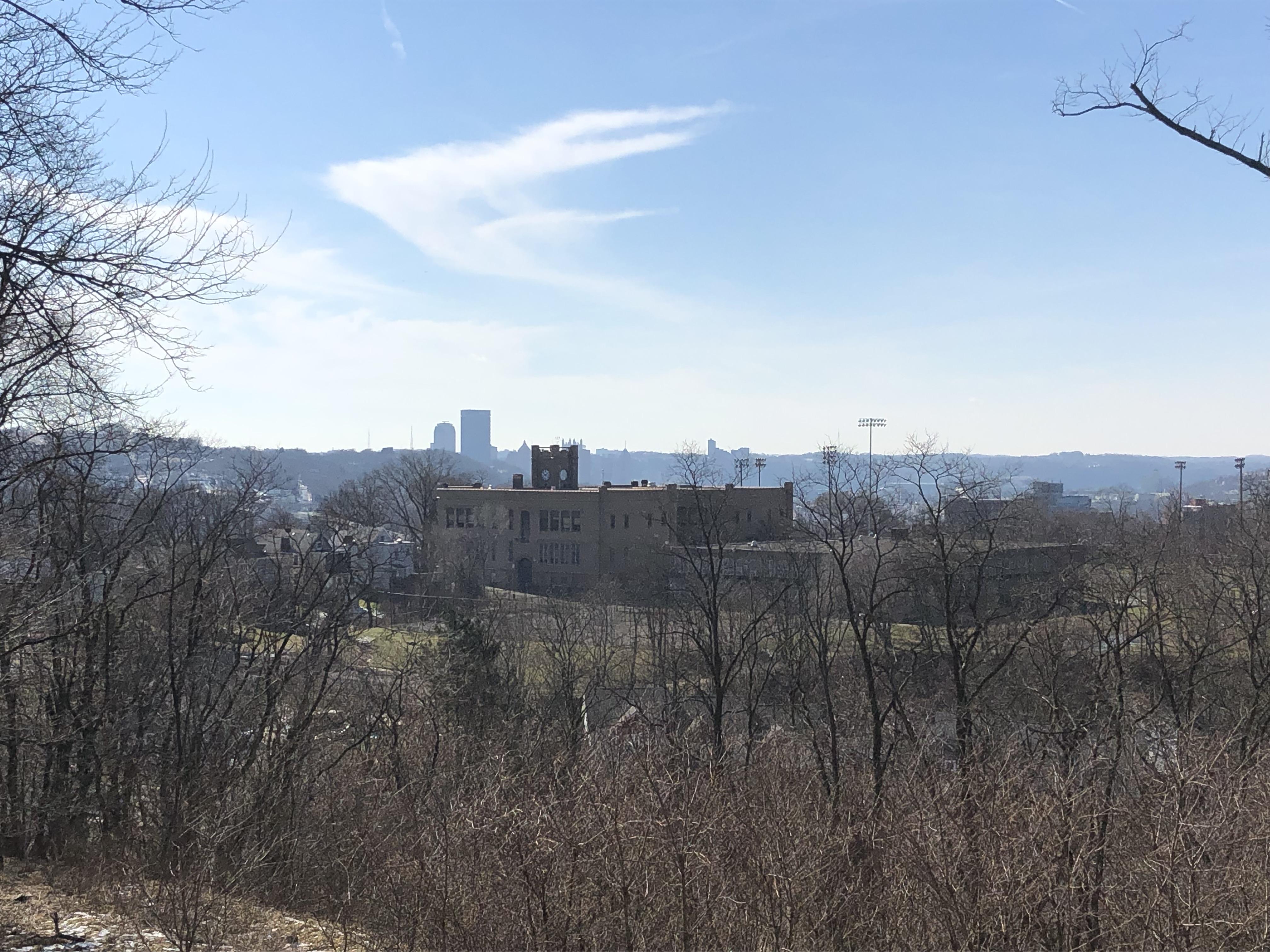
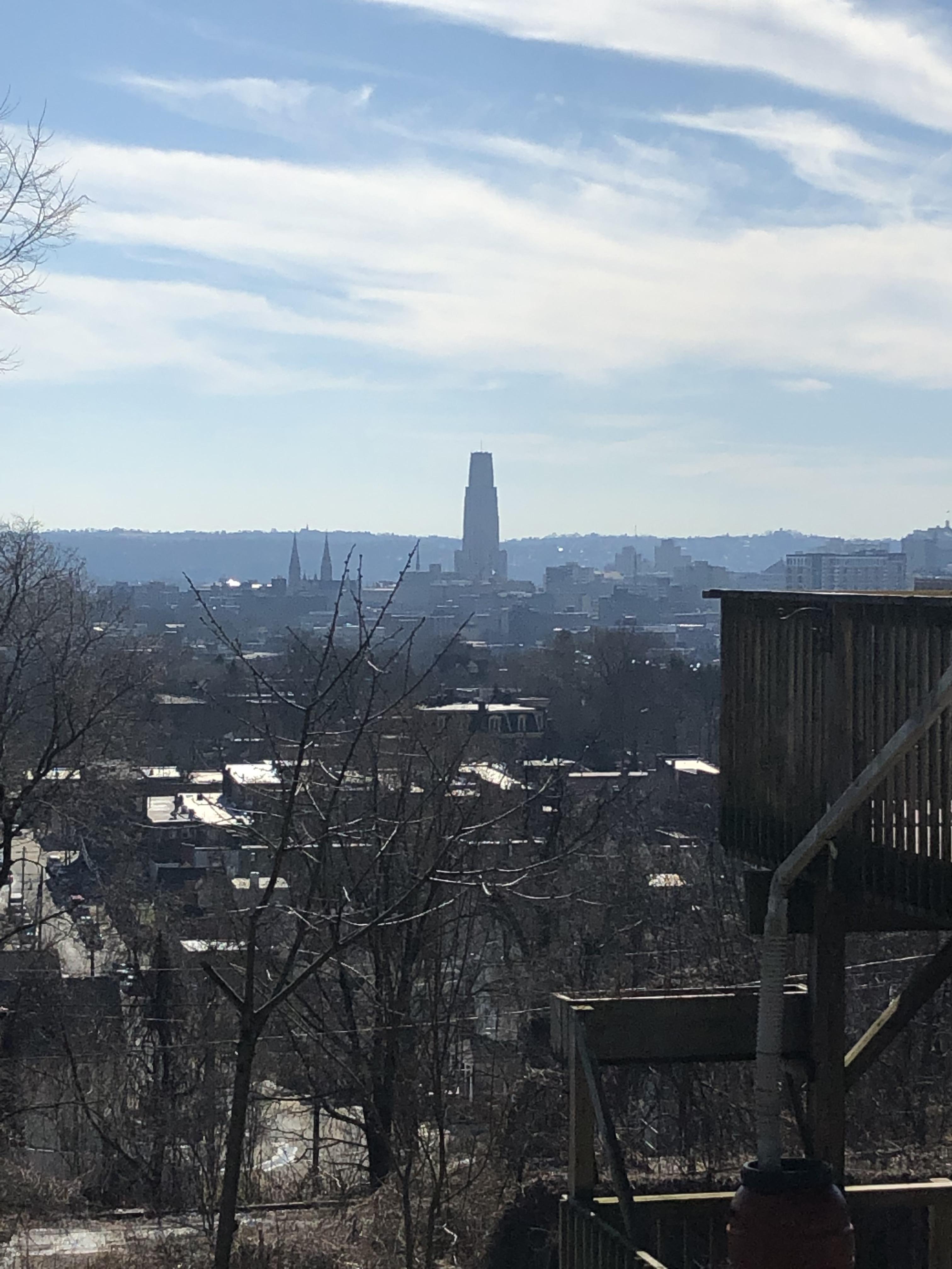
I started my walk on the western portion of the neighborhood near Allegheny Cemetery and made my way north via N Mathilda Street and then Schenley Avenue. The latter part of my walk northward was covered by trees and felt like I was walking into the woods, and not a dense Pittsburgh neighborhood. The typography of Garfield is one of relatively flat streets running west to east in the western and central portions of the neighborhood and avenues that rise in slope as traveled from south to north. In the northern most part of the neighborhood is Garfield Commons, which is a mixed income community comprised of a significant number of public housing units owned by the Housing Authority of the City of Pittsburgh and affordable, moderate and market-rate units for residents not living in public housing. A 6000 feet community center is also available for resident use. Garfield Commons is large and stretches around Schenley Avenue, Columbo Street, Mossfield Street and more. The Water Tower Homes at Garfield Commons are situated off the most northern portion of N. Atlantic Avenue and give way to a beautiful look out where one can see much of the central East End down below and even downtown in the distance. The main issue is its disconnection from the rest of Garfield and the business district below. While residents of the commons have access to the 89 which runs as a looper bus between East Liberty and Garfield, the 89 runs less frequently than the 88 on the neighborhood’s southern border. But residents of the commons have easy access to the Garfield Community Farm off Columbo and Wicklow Street.
Read more : Where Did The Feeding Of The 5000 Take Place
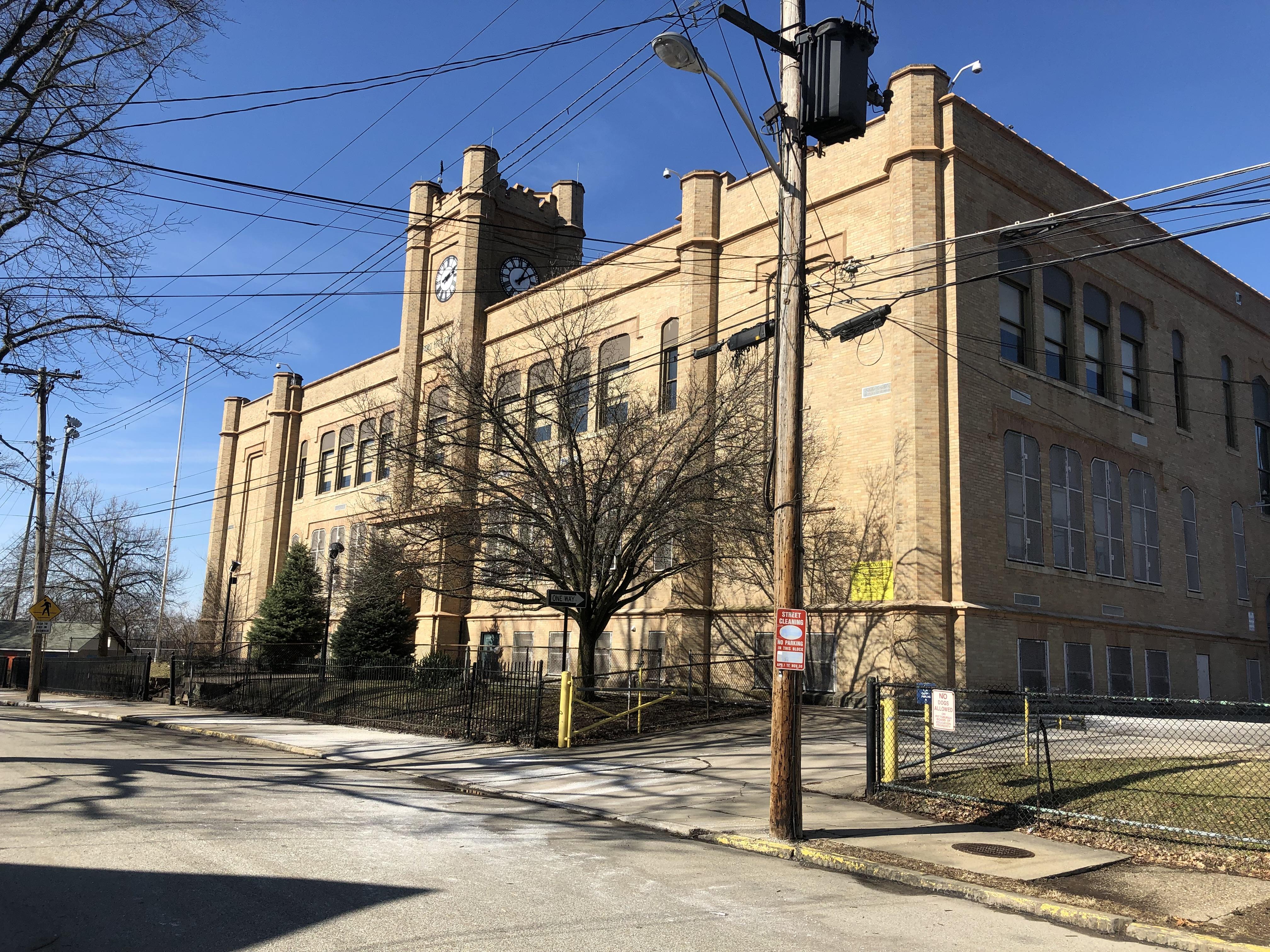
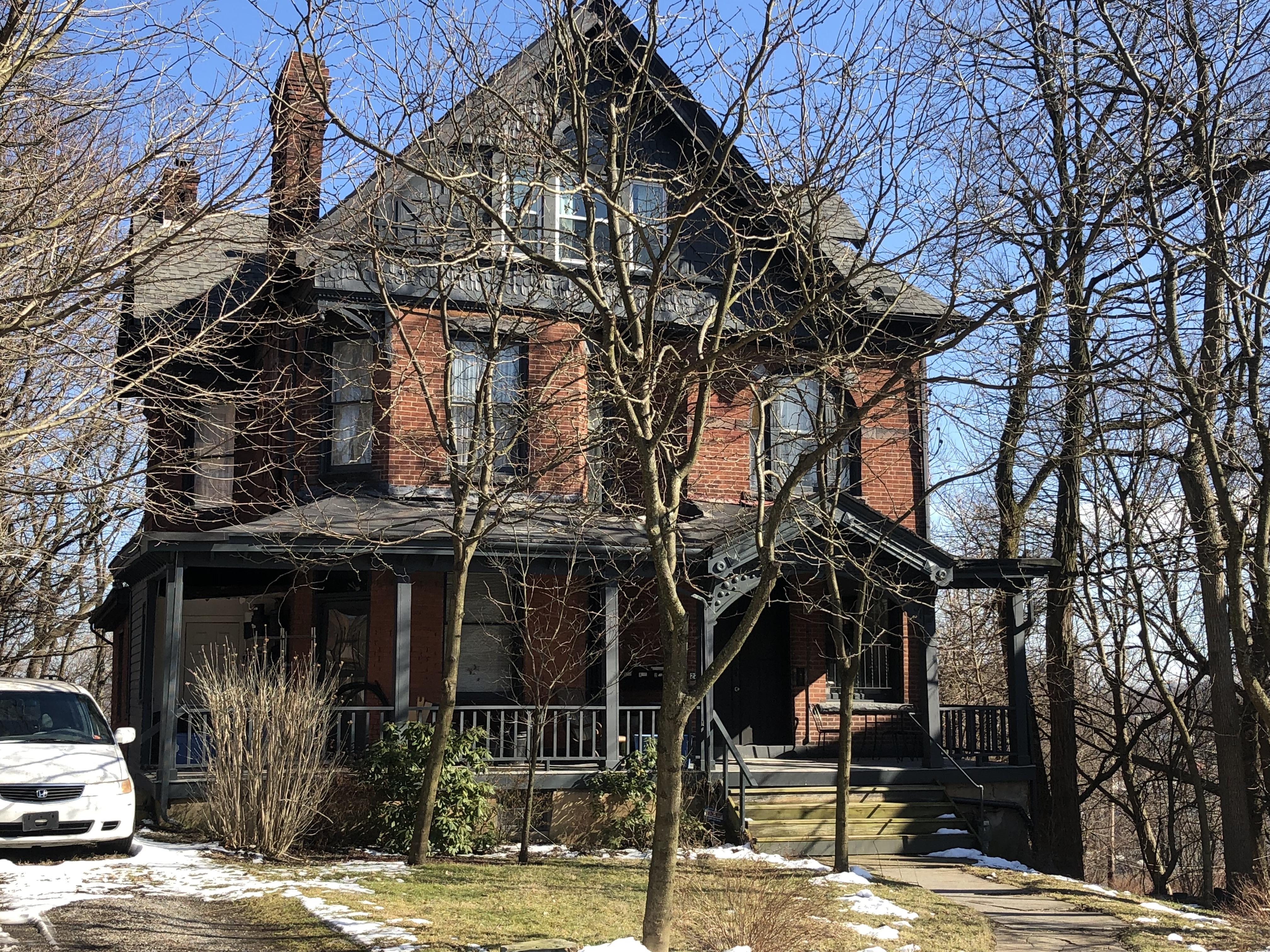
Hillcrest Street is situated in the northern and more traditionally residential part of the neighborhood. Modest brick and single-family homes run throughout the remainder of the neighborhood and larger homes with intricate architectural detail line the most eastern part of Garfield off of N. Fairmount Street. Hillcrest offers beautiful views of Garfield, Friendship and beyond – with the Cathedral of Learning in North Oakland nearly always visible in the distance while walking southward down Garfield’s sloping avenues. Hillcrest is also home to Most Wanted Fine Art, the Hillcrest Urban Farm and the now permanently closed Fort Pitt elementary school – which was listed on the National Register of Historic Places in 1986. The football field directly west of the school is home to the neighborhood’s youth football program the Garfield Gators and connects kids in the program with a structured activity and other mentor and afterschool-based programs in the neighborhood.
The football field is also home to the annual turkey bowl between neighborhood residents on Thanksgiving. But much like Knoxville, gun violence has plagued the neighborhood over the past few decades. From 2012-2017, and according to Public Source, there were 3 incidents of homicide by gun in 2012, 2 in 2013, 5 in 2014, 1 in 2015, 2 in 2016 and 3 in 2017 just from January to mid-august – with Garfield surpassing all other Pittsburgh neighborhoods in the first 6 months of 2017 alone regarding the total of murder by gun, shooting with injury and gun assault with no injury incidents. As just one example of Black lives lost in the neighborhood, a father of five children and a caring husband named Sidney Barlow was tragically taken after trying to break up a dispute during a turkey bowl game way back in 1999.
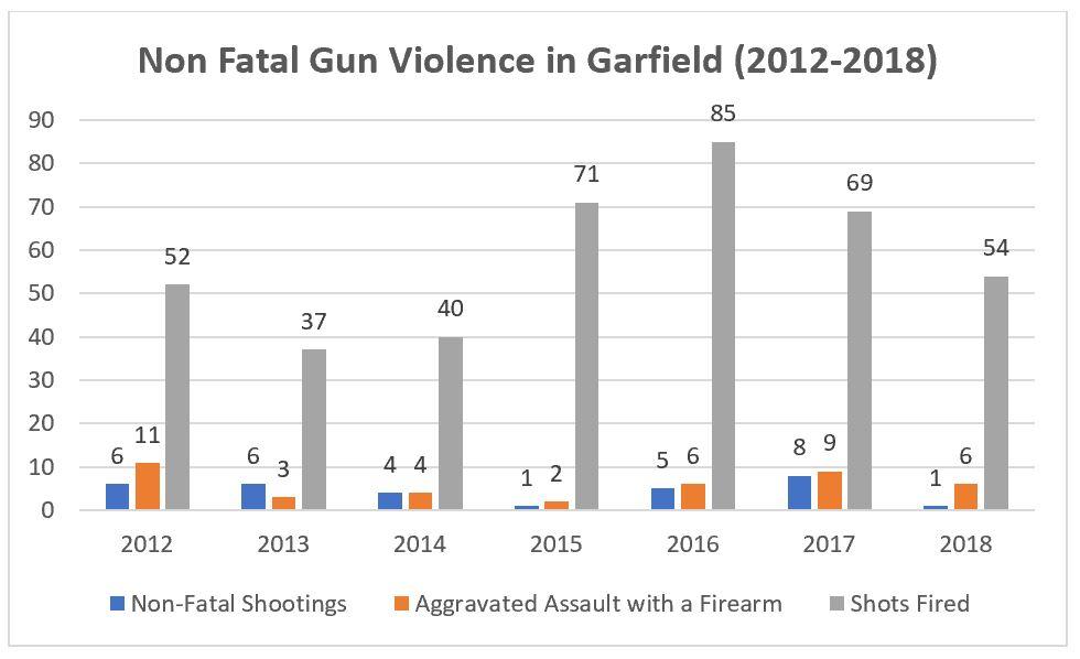
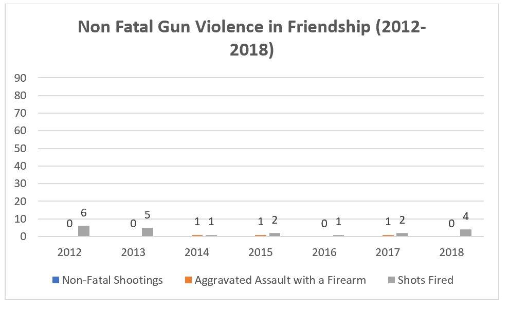
I lived in the neighborhood from the fall of 2014 to the summer of 2017 and never felt unsafe. However, we did hear bursts of gun shots and were well aware of the violence. Community violence has the tendency to be carried out by a small number of individuals who create a disproportionate amount of that crime. It also tends to concentrate in micro areas of a given neighborhood – with the northern part of Garfield tending to see the most heat. And because durable concentrated poverty, rate of single mothers and the male unemployment rate tend to play a large role in predicting violent crime, long-term residents of durably poor neighborhoods like Garfield are often the ones most exposed and subjected to that crime, not newcomers. A deeper look into the economic and structural causes of gun violence can be found in the Knoxville neighborhood profile. As mentioned in the profile, a number of urban sociologists state that gun violence tends to be a product of economic circumstance, high degrees of racial and economic segregation (and thus proximity) and prolonged in-opportunity (which is connected with drug trafficking or “Beefs” between those in various groups) and is not some moral flaw of residents in the neighborhood. A resident who I spoke to said that the gang related violence appears to be declining and mentioned that the neighborhood feels much safer more recently. Her words will be the feature of a future resident interview. However, with the exception of a dip in non-fatal shootings, gun related homicide and aggregated assault in 2015, gun related violence is still clearly and sadly an ongoing issue in the neighborhood. To highlight the divide in gun violence often found between high poverty and low poverty neighborhoods, incidents of non-fatal gun violence for Garfield and Friendship are visible in the graphs below. The graphs are vastly different despite the fact that the two neighborhoods are literally across the street from each other. For an additional divide, the median home value in Friendship is $261,400 and only $72,709 in Garfield – despite their close proximity to one another. And lastly, Garfield is a durably high poverty neighborhood while Friendship is low poverty. Data for the following graphs was gathered via Allegheny County Analytics.
 Garfield is a neighborhood that has seen significant degrees of affordable housing development, mixed income and market rate housing development, investment in the Penn Avenue business corridor and more, but is one that has seen little demographic change and income related change over the past few years and beyond. And as stated, the neighborhood has seen a significant amount of gun related violence. Regarding the area of Garfield that reportedly sees the most gun related violence, Garfield’s northern most census tract has the 9th highest poverty rate among all census tracts in the City of Pittsburgh (45%) and is 89% Black per 2017 ACS estimates – when excluding college student heavy census tracts from the poverty ranking. Additionally, the northern most census tract of the neighborhood has the 16th highest rate of single mothers (20%) and the 7th highest rate of males unemployed or unattached to the labor force (47%) – when excluding student heavy census tracts in the City of Pittsburgh. When looking at the entire neighborhood in the context of all neighborhoods and neighborhood areas in the city, Garfield is the 11th poorest (36%), has the 23rd highest rate of single mothers with children (14%) and the 13th highest rate of working age males who are unemployed or unattached to the labor force (34%).
Regarding neighborhood change from 2012-2017, Garfield has changed on some measures but barely changed on others. Over a period of 27-years Garfield’s poverty rate declined by a mere 2% (38 to 36%) and the White and Black poverty rates have barely budged over the past 5-years. However, like found in our other neighborhood profiles, there is still a huge difference between the percent of Black versus White residents living below the FPL (40% to 23% according to 2017 ACS estimates, respectively). While the rate of working age men has declined over the past 5-years (40% to 34%), the rate of single mothers with children has seen a more significant decline (29% to 14% or a decline of 15%). The rate of those 25 and over without a bachelor’s degree or more also declined by 10% but still sits at a high 76% as of 2017 estimates. While there have been some declines in measures of need, they are still quite high compared to the rest of neighborhoods and neighborhood areas in the city and are consistent with measures of need in other high poverty areas. As a whole, median income has increased by nearly $10,000 (roughly $23,000 in 2012 to $33,000 in 2017). Median income stayed roughly the same for White residents ($37,000) and increased by roughly $7,600 for Black residents (from about $23,400 to $31,000). And there is still a difference of roughly $4,000 in median income between Black and White households. Lastly, measures of value have both increased and decreased in the neighborhood over the 5-year period. Median gross rent increased by about $135 ($699 to $834) and median home value decreased by about $600 ($73,300 to $72,700). Lastly, the neighborhood is overwhelmingly Black with a sizeable White population as of 2017 estimates (72% Black and 18% White). The small remainder of residents are biracial, Asian or Hispanic or Latino. And while White and Black demographics are changing (a 10% increase in the White Population and 11% decrease in the Black population), the neighborhood is still very much majority Black.
Unlike our Manchester profile wherein all measures of need had decreased by sizeable amounts over a short period of time and all measures of income and value had increased over that same period of time (and with Manchester also seeing the second steepest decline in poverty over 27-years), Garfield is much like our Knoxville profile in that some measures of need have stayed the same, some have changed, but all are still quite high comparatively. And while some measures of income and value have increased in Garfield, others have decreased. While an increase in median gross rent of roughly $135 dollars over 5-years may not sound like a lot, it can be sizeable for poor and working-class families and those households on a fixed-income, considering the reality of stagnating wages, rising housing and utility costs and a decrease in federal funds for affordable housing programs. But regarding those last two points, the Bloomfield Garfield Corporation and the Garfield Jubilee Association have built and rehabbed a large number of affordable homes in the neighborhood that are energy-efficient and their programs have allowed a number of a low-income renters to become homeowners through rent to own and income-based home ownership programs. These are necessary strategies that aim to protect the more vulnerable residents of Garfield as the neighborhood changes.
Read more : Where Is Lil Duval From
While affordable and mixed income housing development and commercial corridor revitalization play a role in blight reduction, deconcentrating poverty and protecting longtime residents from involuntary displacement (as neighborhood investments spur greater residential demand overtime), traditional brick and mortar community and economic development will not in and of themselves contribute to meaningful poverty and gun violence reduction. Garfield is a sobering reminder of this. The neighborhood is a truly charming area with breathtaking vistas, solid brick single family homes and a neighborhood social network that often feels tight and welcoming. I loved living in this neighborhood and I once planed on attempting to purchase my first home there someday. But many long-term Black residents live in extreme poverty and those in various subsections of the neighborhood are exposed to near constant gun related non-fatal shootings and to a comparatively sizeable number of fatal and non-fatal gun violence. Although affordable housing development is a necessarily step in stabilizing low-income renters and addressing the city’s affordable housing shortage, Pittsburgh can not simply build its way out of poverty and affordable housing shortages through affordable housing development alone. As mentioned, affordable housing development is a vital strategy to protect vulnerable residents from change and address the affordable housing shortage in this city. But it’s also one that can unintentionally reinforce concentrated poverty if it is primarily targeted to high poverty areas alone, and it is a strategy that may never meet the needed affordable housing demand. And as per research I do professionally, I can firmly say that the bulk of our affordable housing programs are highly segregated in areas of concentrated poverty and disadvantage.
While affordable and mixed income development can help stabilize lower-income residents, I believe that affordable housing development needs to be paired with city-wide efforts to raise the minimum wage, create and connect low-income residents to in-demand/high quality hard skill training programs that are financially accessible and place-based investments that focus on the people of neighborhoods, not just brick and mortar economic development/commercial corridor revitalization. As one resident I spoke to put it, “The art venues on Penn are interesting, but they don’t do much for me and my kids. My kids aren’t into that. And we don’t have the money to go to those new restaurants that are opening up. We can’t eat art.” You can read her full resident interview here. And lastly, perhaps the City’s shift to community policing will have a positive effect on neighborhoods like Garfield, but that remains to be seen. Because the causes of violent crime in high poverty neighborhoods are often related to economic circumstance and prolonged economic in-opportunity, raising the income of residents, connecting them with living wage opportunities and addressing the place-based factors that prime violent crime all must be pursued if the city is serious about significantly and positively impacting those living in extreme poverty; households who are exposed to the conditions that create the opportunity for community violence. And luckily, the Garfield Jubilee Association is hard at work doing market driven workforce development and education development for income eligible 16-24 year olds via its partnership with the Community College of Allegheny County and others through their Garfield YouthBuild program. Only time will tell if such measures can affect the level of disadvantage that so many low-income residents face. And typically, it takes far more than just a few local programs to curb the issues of generational poverty and violence. In that vein, citywide measures will have to compliment what community groups are already doing in neighborhoods like Garfield, if we are to see significant declines in poverty and gun violence. And policy makers must address these challenges through means that do not place vulnerable residents at risk for displacement.
Methodology Notes
All neighborhood level statistics were gathered via census tract level data from the 2012 to 2017 5-year American Community Survey estimates. Citywide statistics were gathered via the 2017 1-year ACS estimates. The 1990 poverty rate was gathered via poverty estimates from the National Historic Geographic Information Systems. The University of Pittsburgh Library System informed which census tracts comprised a given neighborhood in a given year. 2012 dollar amounts, incomes and values were adjusted for inflation using the consumer price index. Because Garfield consists of 3 census tracts, neighborhood level estimates were calculated via a weighted average based on census to neighborhood population proportions.
ACS estimates at the census tract level have sizeable margin or error and this may impact results.
Snippets of broader Pittsburgh history were not cited because they are common knowledge. “Student heavy centers” include all those census tracts within known student heavy locations and those neighborhoods that contain a 4-year college or university.
In neighborhood profiles and data briefs, neighborhoods and neighborhood areas are considered to have a simple racial majority when a given race constitutes 51% of the total population. Otherwise, it is considered a mixed-race neighborhood.
Poverty intervals were informed by standards in neighborhood-level poverty research. Specifically, researcher Patrick Sharkey’s poverty intervals were referenced from his book Stuck in Place – regarding what constitutes an extreme, high, moderate, low or very low poverty neighborhood.
Source: https://t-tees.com
Category: WHERE